United States
£ GBP
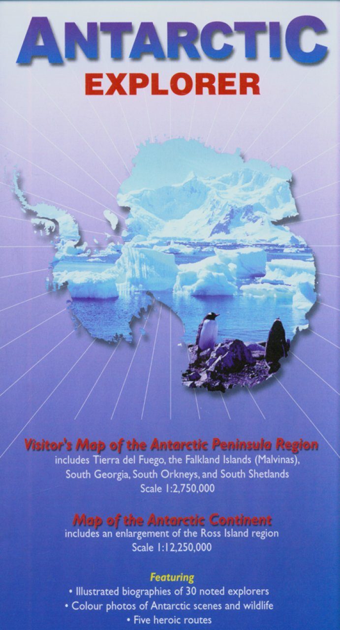
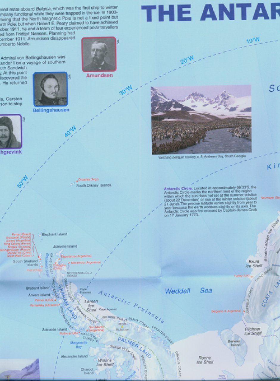
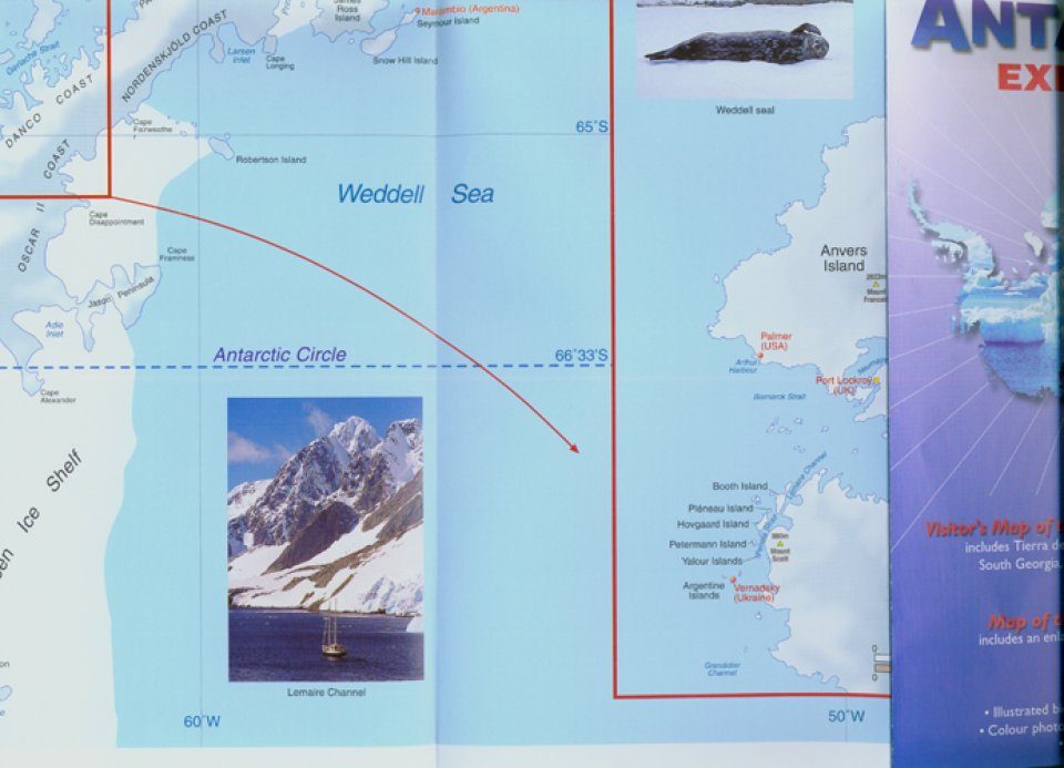
A fold-out visitor's map (scale 1 : 2,750,000 for the Antarctic Peninsula Region and 1 : 12,250,000 for the Antarctic Continent), that measures approximately 100 × 69 cm (W × H) when unfolded. On one side there is a map of the Antarctic continent, around which succinct biographies of Antarctic explorers from William Spiers Bruce to Edward Wilson are shown. On the other side there are many fine colour photographs of seals, penguins and other Antarctic wildlife, together with an inset box summarising the Antarctic Treaty and other information on Antarctic waters, Cape Horn, Tierra del Fuego, the Beagle Channel, the Falkland Islands and South Georgia. Aimed at visitors arriving by sea.
- Map of Antarctica including Tierra del Fuego, the Falkland Islands (Malvinas), South Georgia, South Orkneys and South Shetlands (1 : 2 750 000)
- map of the Antarctic continent including an enlargement of the Ross Island region (1 : 12 250 000)
- the explorers
- the Antarctic Treaty


![Entdecke die Antarktis [Antarctic Explorer]](http://mediacdn.nhbs.com/jackets/jackets_resizer/12/126496.jpg "Entdecke die Antarktis [Antarctic Explorer]")
![Antarctic Explorer [Japanese]](http://mediacdn.nhbs.com/jackets/jackets_resizer/14/145725.jpg "Antarctic Explorer [Japanese]")


![Entdecke Spitzbergen [Spitbergen Explorer]](http://mediacdn.nhbs.com/jackets/jackets_resizer_medium/13/135595.jpg?height=150&width=80)


![Entdecke die Antarktis [Antarctic Explorer]](http://mediacdn.nhbs.com/jackets/jackets_resizer_medium/12/126496.jpg?height=150&width=80)

