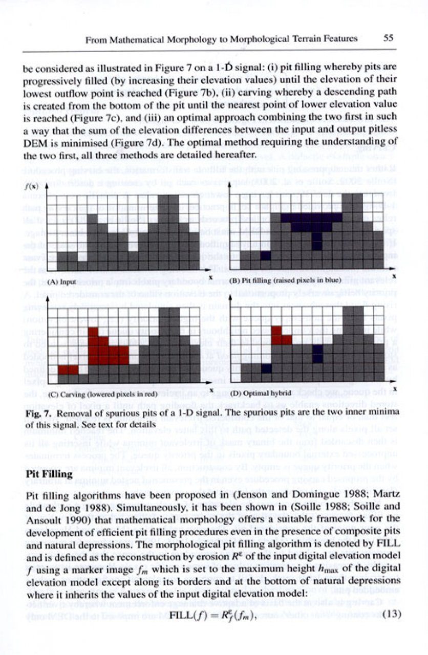
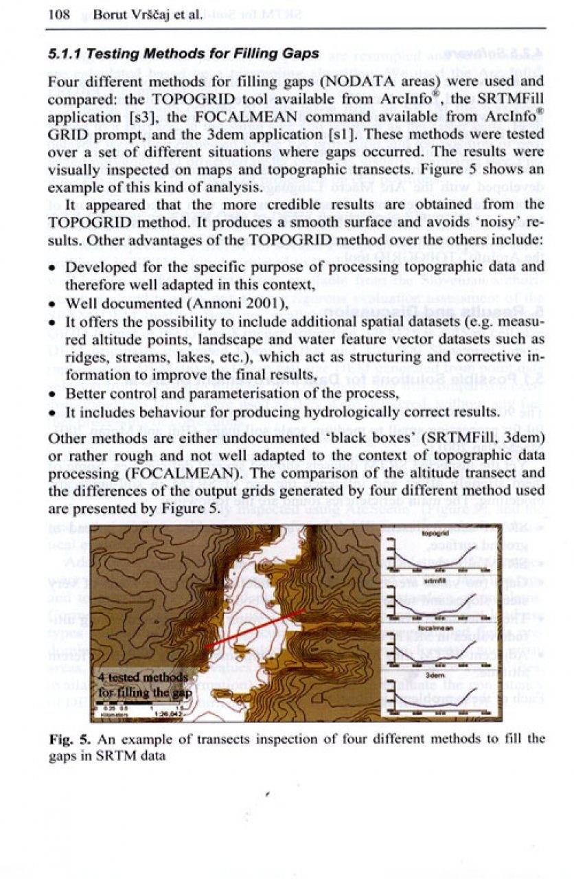
To see accurate pricing, please choose your delivery country.
 
 
United States
£ GBP
All Shops

British Wildlife

8 issues per year 84 pages per issue Subscription only

British Wildlife is the leading natural history magazine in the UK, providing essential reading for both enthusiast and professional naturalists and wildlife conservationists. Published eight times a year, British Wildlife bridges the gap between popular writing and scientific literature through a combination of long-form articles, regular columns and reports, book reviews and letters.

Subscriptions from £33 per year

Conservation Land Management

4 issues per year 44 pages per issue Subscription only

Conservation Land Management (CLM) is a quarterly magazine that is widely regarded as essential reading for all who are involved in land management for nature conservation, across the British Isles. CLM includes long-form articles, events listings, publication reviews, new product information and updates, reports of conferences and letters.

Subscriptions from £26 per year
Academic & Professional Books  Reference  Data Analysis & Modelling  Cartography, Remote Sensing, Image Analysis & GIS

Digital Terrain Modelling Development and Applications in a Policy Support Environment

Edited By: Robert J Peckham and G Jordan
313 pages, 126 illus
Publisher: Springer Nature
Digital Terrain Modelling
Click to have a closer look
  • Digital Terrain Modelling ISBN: 9783540367307 Hardback Jul 2007 Not in stock: Usually dispatched within 1-2 weeks
    £129.99
    #165947
Price: £129.99
About this book Contents Customer reviews Related titles
Images Additional images
Digital Terrain ModellingDigital Terrain ModellingDigital Terrain Modelling

About this book

This publication is the first book on the development and application of digital terrain modelling for regional planning and policy support. It is a compilation of research results by international research groups at the European Commission's Joint Research Centre, providing scientific support to the development and implementation of EU environmental policy. Applications include the pan-European River and Catchment Database, European Flood Alert System, European Digital Soil Database and alternative solar energy resources, all discussed in a GIS framework in the context of the INfrastructure for SPatial InfoRmation in Europe (INSPIRE). This practice-oriented book is recommended to practicing environmental modellers and GIS experts working on regional planning and policy support applications.

Contents

Digital Terrain Analysis in a GIS Environment.- From Mathematical Morphology to Morphological Terrain Features.- Optimisation of Interpolation Parameters Using Cross-validation.- Scale-dependent Effect of Input Data Design on DEM Accuracy.- SRTM as a Possible Source of Elevation Information for Soil-landscape Modelling.- Development of a PAN-European River and Catchment Database.- Decision Supporting Hydrological Model for River Basin Flood Control.- Potential Flood Hazard and Risk Mapping at PAN-European Scale.- High-Resolution DEM for Design of Flood Emergency Reservoirs.- A Quantitative Procedure for Building Physiographic Units for the European Soter Database.- Solar Resource Modelling for Energy Applications.

Customer Reviews

Edited By: Robert J Peckham and G Jordan
313 pages, 126 illus
Publisher: Springer Nature
Current promotions
New and Forthcoming BooksNHBS Moth TrapBritish Wildlife MagazineBuyers Guides