To see accurate pricing, please choose your delivery country.
 
 
United States
£ GBP
All Shops

British Wildlife

8 issues per year 84 pages per issue Subscription only

British Wildlife is the leading natural history magazine in the UK, providing essential reading for both enthusiast and professional naturalists and wildlife conservationists. Published eight times a year, British Wildlife bridges the gap between popular writing and scientific literature through a combination of long-form articles, regular columns and reports, book reviews and letters.

Subscriptions from £33 per year

Conservation Land Management

4 issues per year 44 pages per issue Subscription only

Conservation Land Management (CLM) is a quarterly magazine that is widely regarded as essential reading for all who are involved in land management for nature conservation, across the British Isles. CLM includes long-form articles, events listings, publication reviews, new product information and updates, reports of conferences and letters.

Subscriptions from £26 per year
Academic & Professional Books  Natural History  Regional Natural History  Natural History of the Americas

Massachusetts: Map for Cape Cod National Seashore Massachusetts, USA

Series: Trails Illustrated Maps Volume: 250
By: National Geographic(Author)
1 pages, illustrations
Massachusetts: Map for Cape Cod National Seashore
Click to have a closer look
  • Massachusetts: Map for Cape Cod National Seashore Availability uncertain: order now to get this when available
    £8.99
    #202168
Price: £8.99
About this product Customer reviews Related products

About this product

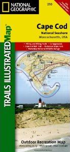
Surrounded by the Atlantic Ocean to the east, north, and south, Nantucket Sound to the southwest, and Cape Cod Bay to the west, Cape Cod is lined with beaches, and interlaced with paths and roads. This map includes the towns of Provincetown, Newcomb Hollow, South Truro, Cahoon Hollow, South Wellfleet, Eastham, Orleans, Dennis, East Dennis, Yarmouth, South Yarmouth, Harwich, North Harwich, East Harwich, and West Chatham. The map shows lighthouses, picnic areas, points of interest, museums and much more, as well as Nickerson State Park, Wellfleet Harbor, Provincetown Harbor, Massachusetts Audobon Societyh Sanctuary, and Monomoy National Wildlife Refuge. Includes UTM grids for use with your GPS unit.

Approximately 4.25" x 9.25" folded; 26" x 38" fully opened
Scale = 1:45,000

Customer Reviews

Series: Trails Illustrated Maps Volume: 250
By: National Geographic(Author)
1 pages, illustrations
Current promotions
New and Forthcoming BooksNHBS Moth TrapBritish Wildlife MagazineBuyers Guides