To see accurate pricing, please choose your delivery country.
 
 
United States
£ GBP
All Shops

British Wildlife

8 issues per year 84 pages per issue Subscription only

British Wildlife is the leading natural history magazine in the UK, providing essential reading for both enthusiast and professional naturalists and wildlife conservationists. Published eight times a year, British Wildlife bridges the gap between popular writing and scientific literature through a combination of long-form articles, regular columns and reports, book reviews and letters.

Subscriptions from £33 per year

Conservation Land Management

4 issues per year 44 pages per issue Subscription only

Conservation Land Management (CLM) is a quarterly magazine that is widely regarded as essential reading for all who are involved in land management for nature conservation, across the British Isles. CLM includes long-form articles, events listings, publication reviews, new product information and updates, reports of conferences and letters.

Subscriptions from £26 per year
Academic & Professional Books  Natural History  Biography, Exploration & Travel

The Sea Chart The Illustrated History of Nautical Maps and Navigational Charts

By: John Blake(Author)
160 pages, 150 colour illustrations
The Sea Chart
Click to have a closer look
Select version
  • The Sea Chart ISBN: 9781591147824 Paperback Sep 2009 Not in stock: Usually dispatched within 2-4 weeks
    £39.99
    #239620
  • The Sea Chart ISBN: 9780851779454 Hardback Jun 2004 Out of Print #152554
Selected version: £39.99
About this book Customer reviews Biography Related titles

About this book

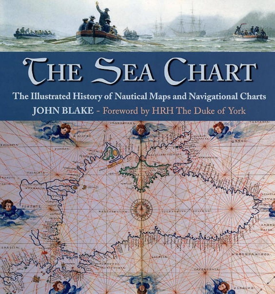
To sail the oceans needed skill as well as courage and experience, and the sea chart with, where appropriate, the coastal view, was the tool by which ships of trade, transport or conquest navigated their course. The Sea Chart looks at the history and development of the chart and the related nautical map, in both scientific and aesthetic terms, as a means of safe and accurate seaborne navigation. The Sea Chart is arranged along chronological and then geographical lines. Each of the ten chapters is split into two distinct halves examining the history of the charting of a particular region and the context under which such charting took place following which specific navigational charts and views together with other relevant illustrations are presented.

Customer Reviews

Biography

John Blake spent nearly seventeen years in the Royal Navy, including the role of navigator. In recent years has developed his intellectual licensing company Classics Licensing which was contracted in 1995 to represent the archives of the UK Hydrographic Office, the largest collection of maritime cartography in the world. He is also a keen maritime historian and writes and lectures internationally on the subject.

By: John Blake(Author)
160 pages, 150 colour illustrations
Current promotions
New and Forthcoming BooksNHBS Moth TrapBritish Wildlife MagazineBuyers Guides