United States
£ GBP
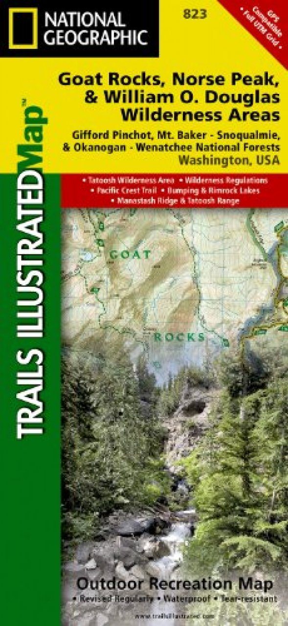
One of five new Trails Illustrated maps for the Washington Cascades region offers the most detailed and up-to-date map for the forest, carefully researched and developed in co-operation with local land managers and agencies. Each map contains easy to read trails, numbered forest service roads, campsites, access points, scenic points-of-interests, and important facilities.
The Goat Rocks Wilderness is a unique area characterized by high alpine terrain and fantastic scenic views. This 105,633 acres wilderness is centered around an ancient volcano which dominated the area some two million years ago. This area features mountainous terrain with elevations between 3,000 and 8,184 feet. Much of this area lies above timberline and provides outstanding scenery. Elk, mountain goats, marmots, deer, and a variety of birds reside within this wilderness.
The Norse Peak Wilderness is located in the central Washington State Cascade Range north of Chinook Pass and east of Mt. Rainier National Park. This 50,923 acre wilderness is names for a prominent peak which overlooks Crystal Mountain Ski Area. The Pacific Crest National Scenic Trail runs along the Cascade ridge in the Norse Peak Wilerness. The historic Naches Pass Trail runs east and west just outside the north Norse Peak Wilderness boundary.
The William O. Douglas Wilderness includes 166,000 acres located between the White Pass and Chinook Pass highways and is jointly administered by the Gifford Pinchot National Forest and the Wenatchee National Forest. The Pacific Crest National Scenic Trail, which extends from Mexico to Canada, runs along the 27-mile crest of this wilderness.
Like all Trails Illustrated maps our new Washington Cascades titles are both highly durable and environmentally friendly. Each map is printed in the United States, at a certified green printer, using low V.O.C. inks on waterproof, tear-resistant material. Proceeds from the sale of Trails Illustrated Maps go to support the National Geographic Society’s nonprofit mission to increase global understanding and promote conservation of our planet through exploration, research, and education.
Coverage includes:
William O. Douglas and Tatoosh Wilderness Areas, Pacific Crest Trail, Bumping and Rimrock Lakes, Manastash Ridge & Tatoosh Range, Chinook and White Pass Scenic Byways Wilderness Coverage: Goat Rocks, Norse Peak, Tatoosh, William O. Douglas Other Attractions: Hiking Trails, Mountain Biking, Campgrounds, Scenic Back Roads, Mountain Climbing, Sno-Parks, Fishing
Approximately 4.25" x 9.25" folded; 26" x 38" fully opened
Scale = 1:75,000 (1 Centimeter = .75 Kilometers; 1 inch = 1.18 Miles)


![Costa Rica Wildlife Guide: Mammals, Birds, Reptiles, Amphibians, Butterflies [English / Spanish]](http://mediacdn.nhbs.com/jackets/jackets_resizer_medium/19/196493.jpg?height=150&width=65)


