United States
£ GBP
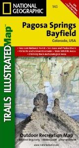
New for southwest Colorado, National Geographic’s Trails Illustrated map “Pagosa Springs & Bayfield” provides detailed coverage for the abundant recreation lands surrounding Pagosa Springs, routinely noted in the media asone of the state’s undiscovered gems.
Designed to meet National Geographic’s high quality standards, Pagosa Springs & Bayfield was completed with the assistance of the San Juan Public Lands Center, a unique cooperative venture between the San Juan field office of the BLM and the San Juan National Forest. These agencies work as a joint entity called the Service First Initiative which allows the USFS and BLM offices to combine resources to improve public-land management.
Like all Trails Illustrated maps, Pagosa Springs & Bayfield contains detailed topographic information, clearly marked roads and trails classified by use, locations of popular recreation areas, and navigational aids for use with a GPS and compass. In addition, all Trails Illustrated maps are printed on waterproof, tear-resistant material, which stands up to rigorous outdoor use.
Coverage Highlights: San Juan National Forest, San Juan & Piedra Rivers, Vallecito & Lemon Reservoir, Chimney Rock Archaeological Area, Piedra Natural Area, Navajo State Park, State Wildlife Areas, and the towns of Pagosa Springs and Bayfield. Overlapping coverage with the newly published TI 144 Durango-Cortez, TI 142 South San Juan – Del Norte, & TI 140 Weminuche.
Approximately 4.25" x 7.5" folded; 22" x 32" fully opened
Scale = 1:63,360


![Costa Rica Wildlife Guide: Mammals, Birds, Reptiles, Amphibians, Butterflies [English / Spanish]](http://mediacdn.nhbs.com/jackets/jackets_resizer_medium/19/196493.jpg?height=150&width=65)


