United States
£ GBP
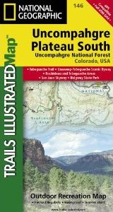
Coverage includes the southeastern portion of the Plateau and Uncompahgre National Forest, as well as Ridgway State Park. On the reverse side of the map, the southwestern portion of Uncompahgre National Forest, including the Naturita Division, is featured as well as the Tabeguache Area, Roubideau Special Management Area, Unaweep/Tabeguache Scenic and Historic Byway, and Dry Creek Basin and Dan Noble State Wildlife Areas. Includes UTM grids for use with your GPS unit.
Approximately 4" x 7.5" folded; 26" x 38" fully opened
Scale = 1:63,360


![Costa Rica Wildlife Guide: Mammals, Birds, Reptiles, Amphibians, Butterflies [English / Spanish]](http://mediacdn.nhbs.com/jackets/jackets_resizer_medium/19/196493.jpg?height=150&width=65)


