To see accurate pricing, please choose your delivery country.
 
 
United States
£ GBP
All Shops

British Wildlife

8 issues per year 84 pages per issue Subscription only

British Wildlife is the leading natural history magazine in the UK, providing essential reading for both enthusiast and professional naturalists and wildlife conservationists. Published eight times a year, British Wildlife bridges the gap between popular writing and scientific literature through a combination of long-form articles, regular columns and reports, book reviews and letters.

Subscriptions from £33 per year

Conservation Land Management

4 issues per year 44 pages per issue Subscription only

Conservation Land Management (CLM) is a quarterly magazine that is widely regarded as essential reading for all who are involved in land management for nature conservation, across the British Isles. CLM includes long-form articles, events listings, publication reviews, new product information and updates, reports of conferences and letters.

Subscriptions from £26 per year
Academic & Professional Books  Natural History  Regional Natural History  Natural History of the Americas

Michigan: Map for Huron National Forest Trails Illustrated Other Rec. Areas

Series: Trails Illustrated Maps Volume: 757
By: National Geographic(Author)
1 pages
Michigan: Map for Huron National Forest
Click to have a closer look
  • Michigan: Map for Huron National Forest Not in stock: Usually dispatched within 2-3 weeks
    £8.99
    #202128
Price: £8.99
About this product Customer reviews Related products

About this product

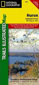
National Geographic's Trails Illustrated map of Huron National Forest is a two-sided, waterproof map designed to meet the needs of outdoor enthusiasts with unmatched durability and detail. This map was created in conjunction with local land management agencies and is loaded with valuable recreation information. 


Trails Illustrated maps are expertly researched and frequently updated. The maps are printed in the United States on durable synthetic paper, making them waterproof, tear-resistant, and trail tough — capable of going anywhere you do. The map is two-sided.

Approximately 4.25" x 9.25" folded; 26" x 38" fully opened
Scale = 1:75,000

Customer Reviews

Series: Trails Illustrated Maps Volume: 757
By: National Geographic(Author)
1 pages
Current promotions
New and Forthcoming BooksNHBS Moth TrapBritish Wildlife MagazineBuyers Guides