United States
£ GBP
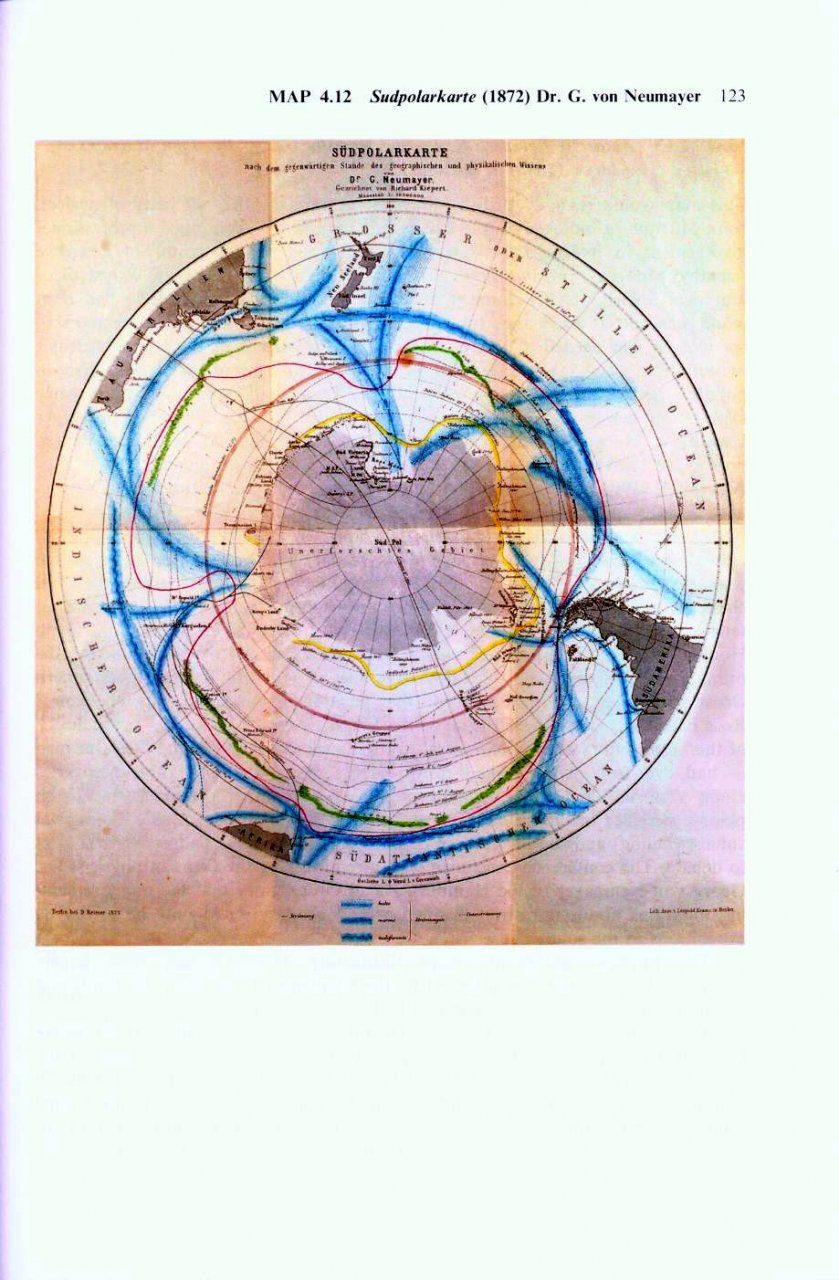
From the time of Ptolomy, men suspected the existence of a large land mass far to the south. Over the centuries, this suspicion slowly grew, until in 1773 James Cook's voyages around the continent confined any land mass to within the Antarctic Circle. Cook's discovery of thousands of seals initiated "an invasion of sealers from around the world who, migrating along the Scotia Arc, further helped to define the limits of the land mass. By 1850, a series of circumnavigations and science-based expeditions searching for the southern magnetic pole had sketched out an Antarctic perimeter.
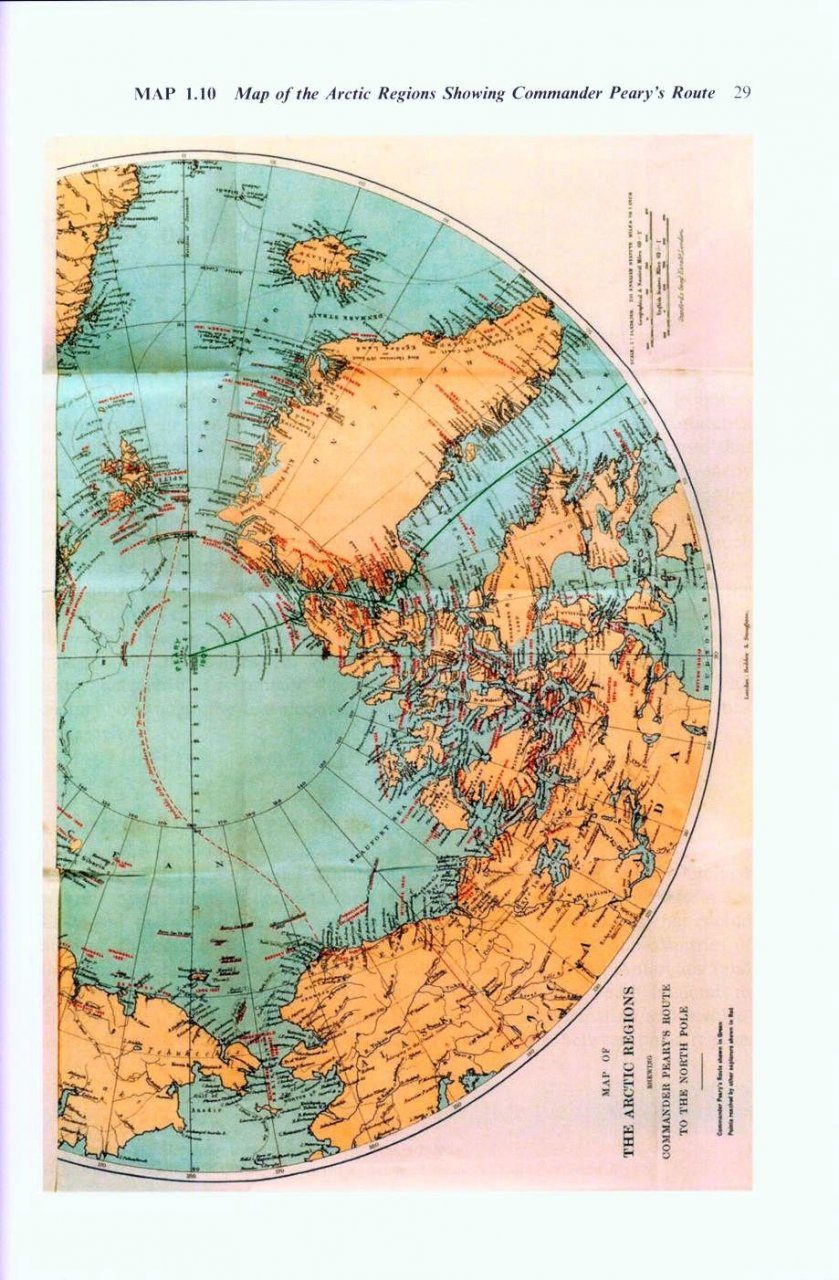
The late 19th and early part of the 20th centuries saw a series of interlinked national expeditions and became known as 'The Heroic Age'. During and after the Second World War, many nations began to take a primary interest in the Antarctic at a political level. Science programmes, especially the International Geophysical Year of 1957-1958, which established coordinated research, and the Antarctic Treaty that followed, have led to a further understanding about the Antartic and its environs.
Mapping Antarctica is about the discovery and exploration of Antarctica, using contemporary maps – most very rare – to tell the story. They represent all the major events, and allow an unusual visual appreciation of change over a relatively short period of time. As well as enabling the wider importance of Antarctica to be recognized, the book's timeframe also allows an assessment of the changes in cartography and the shift in sophistication.
- Introduction
- The Concept: From Ptolemy to Cook
- Arctic and Antarctic regions are not Poles apart
- The Reality: Cook to the International Geographical Congress
- The Heroic Age: Heroes, Legends and Land
- Wings over the Continent: From Wilkins to War
- A Second World War and a New Order of Business
- Antarctica Comes of Age: Windows of the World (1960-2000)
- Post-2000: A new concept of mapping
- Tourism: A different explorer
Robert Clancy is a Member of Order of Australia (for Immunology as well as Historic Cartology). He has made about 6 trips to Antarctica, as both a research scientist and as a tour guide (to both the Antarctic Peninsula and Australian bases). He has been collecting maps of Antarctica since 1972, and has written numerous articles on historic cartography of Australia and Antarctica, given many talks on similar topics and curated four exhibitions of maps related to these topics. He has written three books on maps (So Come They South, The Mapping of Terra Australis, and Shaping Australia: 1850-1950'. He is an International Secretary of the International Map Collectors Society (IMCoS) and has received the Inaugural Innovation Award at the University of Newcastle.
John Manning has had a long career from 1956 to 2004 in surveying, mapping and geodesy in Antarctica and remote areas of Australia. This includes appointments as head of the Antarctic mapping Section of the Division of national mapping and eventually head of the Topographic Mapping Division, as well as chairman or secretary of the SCAR working group on Geodesy and Geographic information over 30 years until 2002. He has been closely involved in modern Australian mapping of the Antarctic since 1966. He has published some 120 technical papers on mapping cartography and photogrammetry. He was a contributing author to the Readers Digest book on Antarctica. He retired from Geoscience Australia in 2004 as Group Leader Geodesy.
Henk Brolsma has had a professional career in surveying and mapping for more than 30 years in different parts of the world. Since 1994 , he has held the position of Mapping officer at the Australian Antarctic Division. In that role he has been in charge of the production of more than a hundred scale maps (small, medium as well as large) of the Australian Antarctic territory in East Antarctica. This also includes a variety of topographic, thematic, bathymetric and satellite mapping. From 1996, he has been fundamentally involved in the establishment of the Australian Antarctic Data Centre and the extended development of its relational data base aspects. This includes an increasing use of aerial photography and satellite remote sensing, such as the application of digital terrain models for ice cap depiction for aviation operations. Today much of his work is involved with the design and delivery of digital online mapping, integrated with selected information such as nomenclature and remotely sensed imagery. He has been an Australian representative in the Scientific Committee for Antarctic research (SCAR) working groups for more than 10 years and is currently the elected chairman of the Standing Committee on Geographic Infrastructure.