United States
£ GBP
Language: English
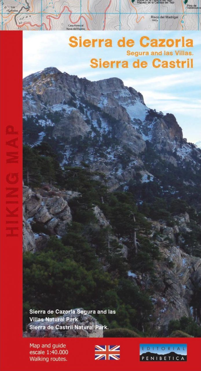
A trekking map of Sierra de Cazorla, in Southern Spain. Accompanied by a 36-page booklet detailing the natural history of the park and providing details for 24 hiking routes.
The Sierras de Cazorla and Castril are south of the massif segureño. The former belongs to Jaén, the latter to Granada, and both are protected natural reserves, joined by a provincial boundary of about 20 miles. The Sierra de Cazorla is limited to the south by the narrow corridor Guadiana Menor that separates or unites, depending how you look, the Sierra Magina, bordered in the west by the olive countryside of Jaén; in the north by the regions of las Villas and Segura, with which it shares the park, and in the east with Castril Natural Park. The Sierra de Castril is embedded in a broad river by the same name, in the north coinciding with the municipal boundaries of the natural park.