United States
£ GBP
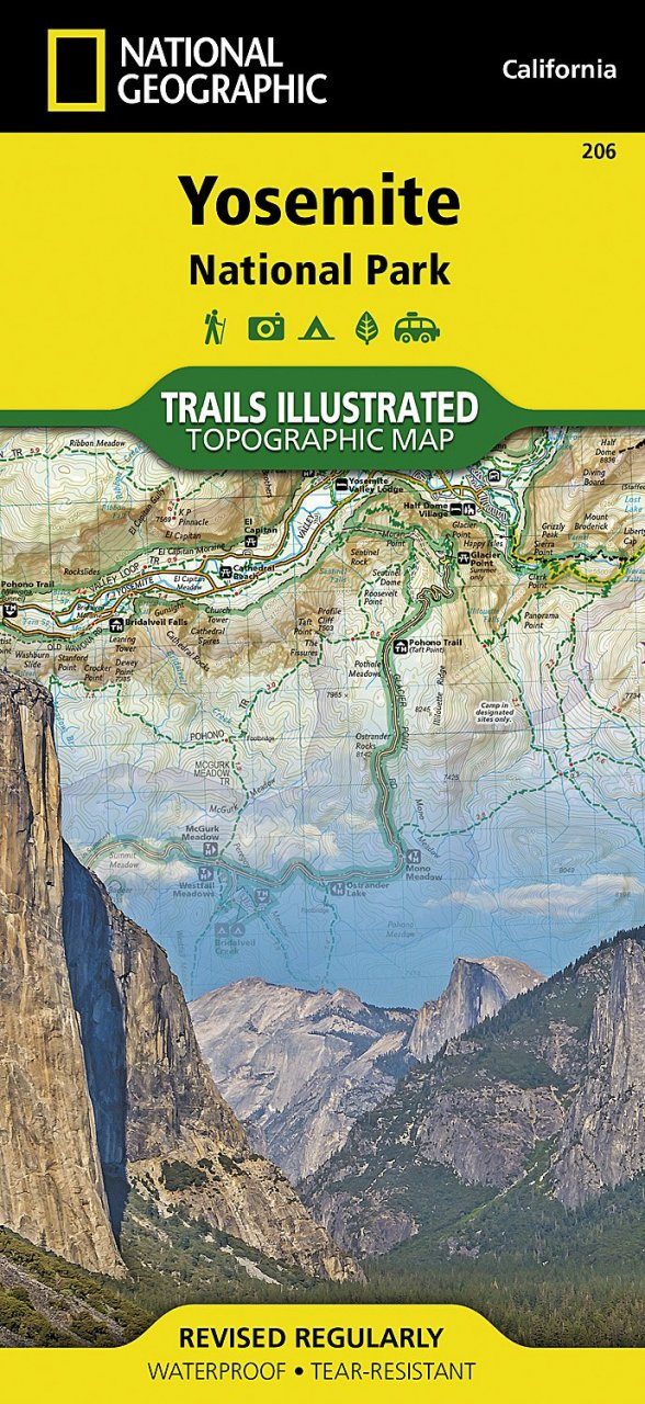
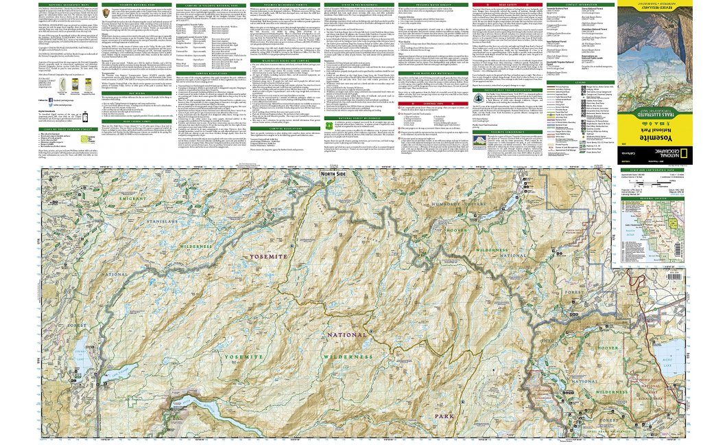
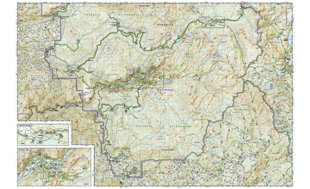
Explore the majesty of Yosemite National Park with National Geographic's Trails Illustrated map. Loaded with helpful information on camping, hiking, lodging, transportation, regulations, and safety, this map is an invaluable tool for casual park visitors and avid adventurers alike. Expertly researched and created in partnership with local land management agencies, the map features key areas of interest including Stanislaus National Forest, Emigrant Wilderness, Carson Iceberg Wilderness, Toiyabe National Forest, Hoover Wilderness, Inyo National Forest, Yosemite Wilderness, Sierra National Forest, and Ansel Adams Wilderness. Detail of the popular Tuolumne Meadows and Yosemite Valley are provided in inset maps.
With almost 800 miles of mapped trails, the Yosemite National Park map can guide you off the beaten path and back again. The clearly marked trails include mileages between intersections. The map base includes contour lines and elevations for summits, passes and major lakes. Some of the many recreation features include: campgrounds, trailheads, tram tours, ski areas, river access, scenic overlooks, scenic byways, and interpretive trails.
Every Trails Illustrated map is printed on "Backcountry Tough" waterproof, tear-resistant paper. A full UTM grid is printed on the map to aid with GPS navigation.
Other features found on this map include: Ansel Adams Wilderness, Bridalveil Fall, Cathedral Range, El Capitan, Emigrant Wilderness, Excelsior Mountain, Hoover Wilderness, Illilouette Falls, Inyo National Forest, Lake Eleanor, Lower Yosemite Fall, Matterhorn Peak, Mount Dana, Mount Lyell, Mount Ritter, Nevada Fall, Ribbon Fall, Ritter Range, Sierra National Forest, Silver Strand Falls, Stanislaus National Forest, Tioga Pass, Toiyabe National Forest, Upper Yosemite Falls, Vernal Fall, Yosemite National Park, Yosemite Valley.
Map Scale = 1:80,000 & 1:40,000
Sheet Size = 37.75" × 25.5"
Folded Size = 4.25" × 9.25"


![Costa Rica Wildlife Guide: Mammals, Birds, Reptiles, Amphibians, Butterflies [English / Spanish]](http://mediacdn.nhbs.com/jackets/jackets_resizer_medium/19/196493.jpg?height=150&width=65)


