To see accurate pricing, please choose your delivery country.
 
 
United States
£ GBP
All Shops

British Wildlife

8 issues per year 84 pages per issue Subscription only

British Wildlife is the leading natural history magazine in the UK, providing essential reading for both enthusiast and professional naturalists and wildlife conservationists. Published eight times a year, British Wildlife bridges the gap between popular writing and scientific literature through a combination of long-form articles, regular columns and reports, book reviews and letters.

Subscriptions from £33 per year

Conservation Land Management

4 issues per year 44 pages per issue Subscription only

Conservation Land Management (CLM) is a quarterly magazine that is widely regarded as essential reading for all who are involved in land management for nature conservation, across the British Isles. CLM includes long-form articles, events listings, publication reviews, new product information and updates, reports of conferences and letters.

Subscriptions from £26 per year
Academic & Professional Books  Natural History  Regional Natural History  Natural History of the Americas

Maine: Map for Acadia National Park

Series: Trails Illustrated Maps Volume: 212
By: National Geographic
Scale: 50Th and 24Th
Maine: Map for Acadia National Park
Click to have a closer look
  • Maine: Map for Acadia National Park Not in stock: Usually dispatched within 2-3 weeks
    £8.99
    #81603
Price: £8.99
About this product Customer reviews Related products

About this product

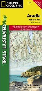
Updated to reflect road closings, new trails, and campground relocation, and includes detailed trail information, points of interest, trailheads, picnic areas, facitlities, and more. 

Features Mount Desert Island, Sestern Mountain, Norwood Ridge, Freeman Ridge, Isle au Haut, Marshall Island, Swans Island, Western Bay, Mount Desert Narrows, Eastern May, Frenchman Bay, Eastern Way, Eastern Passage, Long Pond, Seal Cove Pond, Echo Lake, Somes Sound, Upper and Lower Hadlock Pond, Jordan Pond, and Eagle Lake. Includes UTM tick marks for use with your GPS.

Approximately 4.25" x 9.25" folded; 26" x 38" fully opened
Scale = 1:35,000 & 1:100,000

Customer Reviews

Series: Trails Illustrated Maps Volume: 212
By: National Geographic
Scale: 50Th and 24Th
Current promotions
New and Forthcoming BooksNHBS Moth TrapBritish Wildlife MagazineBuyers Guides