To see accurate pricing, please choose your delivery country.
 
 
United States
£ GBP
All Shops

British Wildlife

8 issues per year 84 pages per issue Subscription only

British Wildlife is the leading natural history magazine in the UK, providing essential reading for both enthusiast and professional naturalists and wildlife conservationists. Published eight times a year, British Wildlife bridges the gap between popular writing and scientific literature through a combination of long-form articles, regular columns and reports, book reviews and letters.

Subscriptions from £33 per year

Conservation Land Management

4 issues per year 44 pages per issue Subscription only

Conservation Land Management (CLM) is a quarterly magazine that is widely regarded as essential reading for all who are involved in land management for nature conservation, across the British Isles. CLM includes long-form articles, events listings, publication reviews, new product information and updates, reports of conferences and letters.

Subscriptions from £26 per year
Academic & Professional Books  Natural History  Regional Natural History  Natural History of the Americas

Utah: Map for Canyonlands National Park

Series: Trails Illustrated Maps Volume: 210
By: National Geographic(Author)
Scale: 62.5Th
Utah: Map for Canyonlands National Park
Click to have a closer look
  • Utah: Map for Canyonlands National Park Not in stock: Usually dispatched within 2-3 weeks
    £8.99
    #81621
Price: £8.99
About this product Customer reviews Related products

About this product

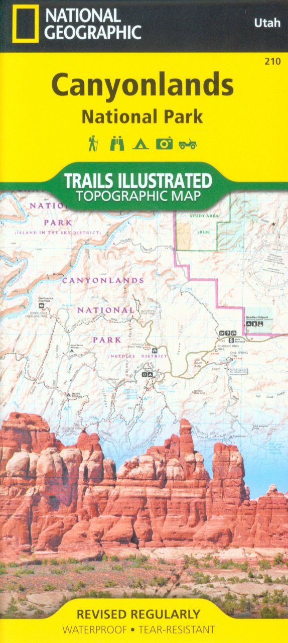
This map is updated to reflect road closings, new trails, and campground relocation, and includes detailed trail information, points of interest, trailheads, picnic areas, facitlities, and more. 

Included on the map are Canyonlands National Park, the Island in the Sky district, the Needles district, and the Maze district. The map also includes the Colorado River, the Green River, Indian Creek Wilderness, Bridger Jack Mesa Wilderness, Butler Wash Wilderness, Canyon Rims Recreation Area, and fascinating information about the park's archaeology. Ideal for recreation activities in this beautiful area, including hiking, biking, camping, climbing, photography--any back-country outdoor activity. Includes UTM grids for use with your GPS unit.

Approximately 4.25" × 9.25" folded; 26" × 38" fully opened
Scale = 1:70,000

Customer Reviews

Series: Trails Illustrated Maps Volume: 210
By: National Geographic(Author)
Scale: 62.5Th
Current promotions
New and Forthcoming BooksNHBS Moth TrapBritish Wildlife MagazineBuyers Guides