To see accurate pricing, please choose your delivery country.
 
 
United States
£ GBP
All Shops

British Wildlife

8 issues per year 84 pages per issue Subscription only

British Wildlife is the leading natural history magazine in the UK, providing essential reading for both enthusiast and professional naturalists and wildlife conservationists. Published eight times a year, British Wildlife bridges the gap between popular writing and scientific literature through a combination of long-form articles, regular columns and reports, book reviews and letters.

Subscriptions from £33 per year

Conservation Land Management

4 issues per year 44 pages per issue Subscription only

Conservation Land Management (CLM) is a quarterly magazine that is widely regarded as essential reading for all who are involved in land management for nature conservation, across the British Isles. CLM includes long-form articles, events listings, publication reviews, new product information and updates, reports of conferences and letters.

Subscriptions from £26 per year
Academic & Professional Books  Natural History  Regional Natural History  Natural History of the Americas

Utah: Map for Arches National Park

Series: Trails Illustrated Maps Volume: 211
By: National Geographic(Author)
Scale: 50Th
Utah: Map for Arches National Park
Click to have a closer look
  • Utah: Map for Arches National Park Not in stock: Usually dispatched within 2-3 weeks
    £12.99
    #81619
Price: £12.99
About this product Customer reviews Related products

About this product

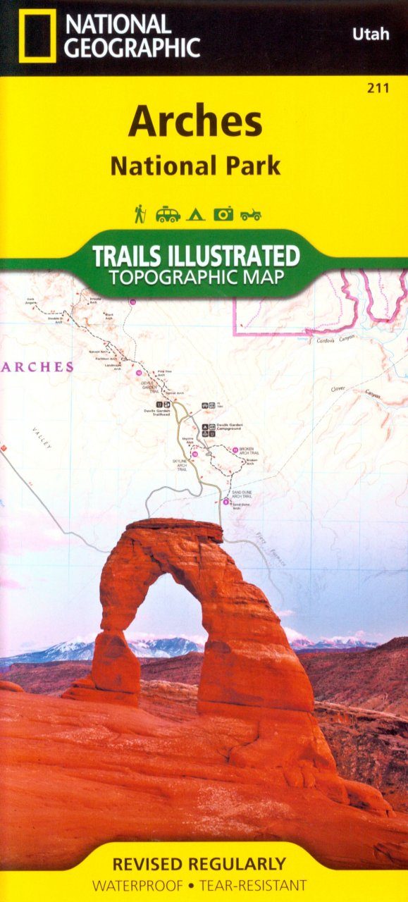
This map is updated to reflect road closings, new trails, and campground relocation, and includes detailed trail information, points of interest, trailheads, picnic areas, facitlities, and more. Included on the map are Arches National Park, The Highlands, Little Valley, Devils Garden, Lost Spring Canyon Wilderness area, Negro Bill Wilderness area, Scott M. Matheson Wetlands Preserve, Cache Valley, Delicate Arch, Broken Arch, Sand Dune Arch, Pine Tree Arch, Private Arch, Dark Angel, Double Arch, and more. The map also includes the Colorado River, the Windows Section, Petrified Dunes, and fascinating information about the park's geology, archaeology, history, and culture. Includes UTM grids for use with your GPS unit.

Approximately 4.25" × 9.25" folded; 26" × 38" fully opened
Scale = 1:28,600

Customer Reviews

Series: Trails Illustrated Maps Volume: 211
By: National Geographic(Author)
Scale: 50Th
Current promotions
New and Forthcoming BooksNHBS Moth TrapBritish Wildlife MagazineBuyers Guides