United States
£ GBP
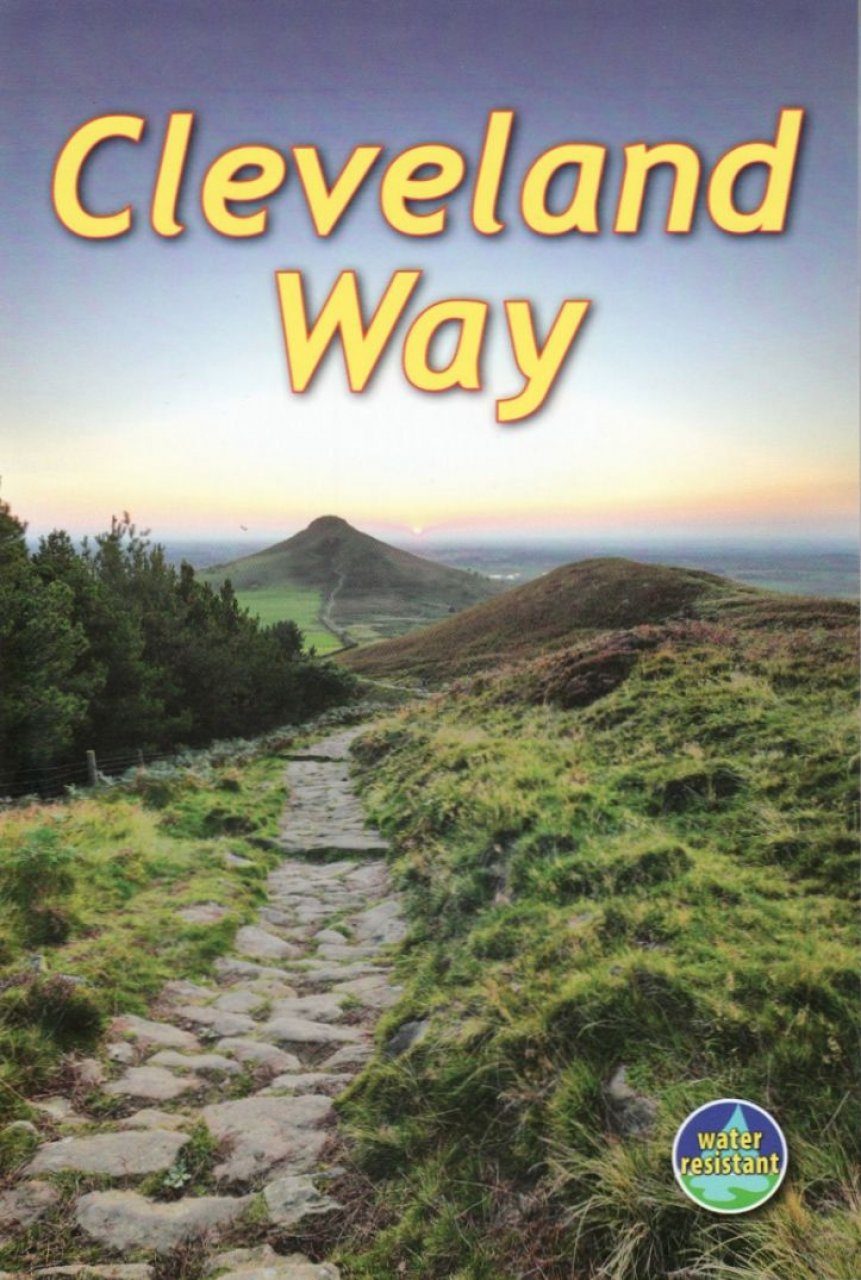
The Cleveland Way is one of England's oldest and best-loved National Trails. It runs for 110 miles (177 km) around the North York Moors National Park, starting inland at Helmsley, offering panoramic views over the vales of York and Mowbray and from the Cleveland Hills. After reaching the coast at Saltburn, it heads south along the dramatic sea cliffs, with their tales of shipwrecks and smugglers, to end at Filey. The route features prehistoric burial mounds, ancient castles, abbeys and Roman remains, with more recent traces of industrial history. Vast areas of heather moorland are host to secretive wildlife. The Cleveland Way is easily accessible by public transport and is divided into easy stages by villages of character with friendly pubs and accommodation. Above all, the walker is welcomed with warm Yorkshire hospitality. This guidebook contains all you need to plan and enjoy your Cleveland Way walk: detailed route descriptions background on geology, pre-history and history illustrated information about wildlife map of the entire route in 5 drop-down panels (1:120,000) information about public transport and travel lavishly illustrated, with 75 colour photographs on water-resistant paper.
Gordon Simm is a semi-retired engineer, a long-distance walker and a keen photographer. He was born a "townee" but always loved the countryside, and in the early eighties he moved with his young family to rural North Yorkshire on the edge of the North Yorks Moors National Park. A keen bird-watcher, Gordon's interest in photography grew as he developed his skills in using a camera to record landscape and wildlife. His first venture into long-distance walking was on the Cleveland Way in 1989. Since leaving full-time work in 2003, he has completed several other National Trails, and co-authored a Rucksack Reader on Hadrian's Wall Path. In 2011 he won the title "Photographer of the Year" in a Panasonic Lumix competition and had his photos showcased at the Focus-on-Imaging 2011 event at the NEC.
After a long career in education, information technology and academic publishing, Jacquetta Megarry became interested in long-distance walking and trekking. After completing the West Highland Way, her first long walk, in 1998, she progressed to Mount Kilimanjaro, which she summited four times by different routes. In 2000 she devised the waterproof, open-flat Rucksack Reader format with dropdown maps for walking guidebooks. She has since written or co-authored about 15 guidebooks and edited as many again.