To see accurate pricing, please choose your delivery country.
 
 
United States
£ GBP
All Shops

British Wildlife

8 issues per year 84 pages per issue Subscription only

British Wildlife is the leading natural history magazine in the UK, providing essential reading for both enthusiast and professional naturalists and wildlife conservationists. Published eight times a year, British Wildlife bridges the gap between popular writing and scientific literature through a combination of long-form articles, regular columns and reports, book reviews and letters.

Subscriptions from £33 per year

Conservation Land Management

4 issues per year 44 pages per issue Subscription only

Conservation Land Management (CLM) is a quarterly magazine that is widely regarded as essential reading for all who are involved in land management for nature conservation, across the British Isles. CLM includes long-form articles, events listings, publication reviews, new product information and updates, reports of conferences and letters.

Subscriptions from £26 per year
Academic & Professional Books  Natural History  Regional Natural History  Natural History of the Americas

Michigan: Map for Isle Royale National Park

Series: Trails Illustrated Maps Volume: 240
By: National Geographic
Scale: 62.5Th
Michigan: Map for Isle Royale National Park
Click to have a closer look
  • Michigan: Map for Isle Royale National Park Not in stock: Usually dispatched within 2-3 weeks
    £8.99
    #81604
Price: £8.99
About this product Customer reviews Related products

About this product

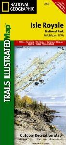
This Trails Illustrated topographic map for Isle Royale National Park, north of the Upper Peninsula of Michigan in Lake Superior, is the perfect map for hiking, paddling, boating, biking, exploring, climbing, camping, and sightseeing in this beautiful area. 

The map includes Isle Royale, Washington Island, Grace Island, Johns Island, Thompson Island, Amygdaloid Island, Belle Island, Passage Island, Windigo, Minong Ridge, Greenstone Ridge, Feldtmann Ridge, Malone Bay, Siskiwit Lake, Lake Richie, Chickenbone Lake, Moskey Basin, Rock Harbor, and much more. Includes UTM grids for use with your GPS unit.

Approximately 4.25" x 9.25" folded; 26" x 38" fully opened
Scale = 1:50,000

Customer Reviews

Series: Trails Illustrated Maps Volume: 240
By: National Geographic
Scale: 62.5Th
Current promotions
New and Forthcoming BooksNHBS Moth TrapBritish Wildlife MagazineBuyers Guides