United States
£ GBP
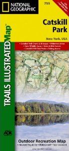
National Geographic's recreational map of Catskill Park is a two-sided, waterproof map designed to meet the needs of outdoor enthusiasts with unmatched durability and detail. This map was created in partnership with the Adirondack Mountain Club (ADK) which provided trail information from its Forest Preserve Series of trail guides. Loaded with valuable information about recreating in the park, the map also includes a UTM and Latitude/Longitude grid, as well as selected waypoints and a scale bar for easy and accurate navigation.
Our Catskill Park map is printed in the U.S.A. on durable synthetic paper, making it waterproof, tear-resistant, and trail tough — capable of going anywhere you do.
Approximately 4.25" x 9.25" folded; 26" x 38" fully opened
Scale = 1:75,000


![Costa Rica Wildlife Guide: Mammals, Birds, Reptiles, Amphibians, Butterflies [English / Spanish]](http://mediacdn.nhbs.com/jackets/jackets_resizer_medium/19/196493.jpg?height=150&width=65)


