United States
£ GBP
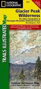
One of five new Trails Illustrated maps for the Washington Cascades region offering the most detailed and up-to-date map for the forest, carefully researched and developed in co-operation with local land managers and agencies. Each map contains easy to read trails, numbered forest service roads, campsites, access points, scenic points-of-interests, and important facilities.
The Glacier Peak Wilderness, created by Congress in the 1964 Wilderness Legislation, is located within portions of Chelan, Snohomish, and Skagit Counties in the northern Cascade Mountains of Washington State. The area, 576,900 acres in size, is characterized by heavily forested stream courses, steep-sided valleys, and dramatic glacier crowded peaks. Forest vegetation is comprised of true firs, spruce, and hemlock, as well as stands of pine on its eastern slopes. Various species of wildlife inhabit the area and include deer, elk, bear, mountain goat, cougar, marten, and lynx. The primary fishery is cutthroat trout, however, other species do exist there as well.
Recreation opportunities, as well as solitude abound with more than 450 miles of trail and many places where one can enjoy cross-country travel. Because of the popularity of the area, there have been some restrictions put in place in order to protect its unique wilderness character.
Like all Trails Illustrated maps our new Washington Cascades titles are both highly durable and environmentally friendly. Each map is printed in the United States, at a certified green printer, using low V.O.C. inks on waterproof, tear-resistant material. Proceeds from the sale of Trails Illustrated Maps go to support the National Geographic Society’s nonprofit mission to increase global understanding and promote conservation of our planet through exploration, research, and education.


")

![Costa Rica Wildlife Guide: Mammals, Birds, Reptiles, Amphibians, Butterflies [English / Spanish]](http://mediacdn.nhbs.com/jackets/jackets_resizer_medium/19/196493.jpg?height=150&width=65)


