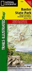
About this product
National Geographic's recreational map of Baxter State Park / Mount Katahdin is a two-sided, waterproof map designed to meet the needs of outdoor enthusiasts with unmatched durability and detail. Loaded with valuable information about hiking, camping, and fishing in the park, the map also includes a UTM and Latitude/Longitude grid, as well as compass rose and scale bar for easy and accurate navigation.
Year-round activities abound in the park and the location of scenic viewpoints, wildlife viewing, boat launches and canoe carry downs, lookout towers, amphitheaters, ATV trails, and other points of interest are clearly marked as are park boundaries and access points. Campers will appreciate the attention paid to noting the variety of camping facilities available including primitive campsites, group campsites, rental cabins, RV camping, picnic shelters, restrooms, parking, and trailheads. Appalachian Mountain Club operated lodges, huts, backcountry shelters and campsites are included as well. Whether paddling the Northern Forest Canoe Trail, camping in the North Maine Woods, or hiking the Appalachian Trail, these maps perform as highly functional travel tools that are as useful as they are remarkably crafted.
The front of the Baxter State Park map details the south half of the park from the lower half of the Main Public Woods – Nahmakanta Lake Unit and includes Roach Ponds, the Katahdin Iron Works, and the KI- JO Mary Multiple Use Forest. The northern half of the park appears on the back of the map and includes Mount Katahdin as well as the Main Public Woods – Telos Unit, the Debsconeag Lakes Wilderness Area, and the upper half of the Nahmakanta Lake Unit.
Our Baxter State Park / Mount Katahdin map is printed in the U.S.A. on durable synthetic paper, making it waterproof, tear-resistant, and trail tough — capable of going anywhere you do. The map is two-sided, and can be folded to a packable size of (4.25” x 9.25”), unfolded size is (26” x 38”).
Net proceeds from the sale of this map go to support the nonprofit mission of the National Geographic Society.
Popular Places Included on the Map
Mount Katahdin, Katahdin Iron Works, Roach Ponds, Barren Mountain, Earley Landing Falls, Greenwood Ponds, Appalachian Trail, KI-JO Forest, Katahdin Lake, Northern Forest Canoe Trail, Gulf Hagas
Key Features:
- Waterproof and tear-resistant
- Detailed topography and clearly defined, color-coded boundaries of state parks, ecological reserves, and more
- Helpful park information including checkpoints, visitor centers, and ranger stations
- Northern Forest Canoe Trail
- Appalachian Trail and Appalachian Mountain Club lodge, huts, shelters, and campsites
- Hundreds of points-of-interest, including the location of campsites, scenic viewpoints, wildlife viewing, boat launches, canoe carry downs, lookout towers, and amphitheaters
- Latitude/Longitude, UTM, and Magnetic Declination – for use with GPS and Compass
- About Baxter State Park / Mount Katahdin
Governor Percival P. Baxter so enjoyed vacationing in the Maine woods as a child, he purchased nearly 6,000 acres of land in 1930 to fulfill his dream of creating a park. The park that bears his name now covers 209,501 acres and includes Mount Katahdin, Maine’s highest peak. About 75% of the park is managed as a wildlife sanctuary. The northwest corner of the park is managed as the Scientific Forest Management Area and is a showplace for sound forestry. Paddling, hiking, camping, mountain climbing, fishing, and wildlife viewing make this park a popular destination for outdoor enthusiasts of all ages and activity levels.
Customer Reviews


![Costa Rica Wildlife Guide: Mammals, Birds, Reptiles, Amphibians, Butterflies [English / Spanish]](http://mediacdn.nhbs.com/jackets/jackets_resizer_medium/19/196493.jpg?height=150&width=65)