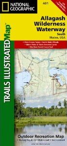
About this product
National Geographic's recreational maps (TI 400 and 401) of the Allagash Wilderness Waterway are two- sided, waterproof maps designed to meet the needs of outdoor enthusiasts and tourists alike. Divided into two separate maps for exceptional detail, each is loaded with valuable information such as watercraft regulations, rules for recreational use and access, river difficulty scale, checkpoints, visitor and ranger station locations, and more. A UTM and Latitude/Longitude grid, as well as compass rose and scale bar will keep you pointed in the right direction.
Year-round activities abound in the region and the location of scenic viewpoints, wildlife viewing, boat launches and canoe carry downs, lookout towers, amphitheaters, ATV trails, and other points of interest are clearly marked as are park and forest boundaries and access points. Campers will appreciate the attention paid to noting the variety of camping facilities available including primitive campsites, group campsites, rental cabins, RV camping, picnic shelters, restrooms, parking, and trailheads. Whether paddling the Northern Forest Canoe Trail, camping in the North Maine Woods, or driving the Maine Scenic Byway, these maps perform as highly functional travel tools that are as useful as they are remarkably crafted.
The Allagash Wilderness Waterway North map details the far northern reaches of the waterway on the Canadian border south to Churchill Lake. The front or north side of the map includes the area stretching from the Fort Kent State historic site on the Saint John River south to Saint Froid Lake. It also includes the Saint Francis, Fish, and Allagash Rivers, and the northern portion of Eagle Lake. The south side of the map shows Long Lake, Umsaskis Lake, the five Musquacook lakes, Spider Lake, and Pleasant Lake.
Our Allagash Wilderness Waterway North map is printed in the U.S.A. on durable synthetic paper, making it waterproof, tear-resistant, and trail tough — capable of going anywhere you do. The map is two-sided, and can be folded to a packable size of (4.25” x 9.25”), unfolded size is (26” x 38”).
Net proceeds from the sale of this map go to support the nonprofit mission of the National Geographic Society.
Popular Places Included on the Map
Northern Forest Canoe Trail, Fort Kent State, Saint John River, Saint Froid Lake, Round Pond, Allagash River, Maine Scenic Byway, Umsaskis Lake, Fish River, Long Lake, Debouille Ecological Reserve, the Musquacook lakes
Key Features:
Waterproof and tear-resistant
- Detailed topography and clearly defined, color-coded boundaries of state parks, ecological reserves, easements, and more
- Helpful information including watercraft regulations, recreational use rules, access points, river difficulty scale, checkpoints, visitor centers, and ranger stations
- Northern Forest Canoe Trail
- American Canoe Association safety and trip planning tips
- Hundreds of points-of-interest, including the location of campsites, scenic viewpoints, wildlife viewing, boat launches, canoe carry downs, lookout towers, and amphitheaters
- Latitude/Longitude, UTM, and Magnetic Declination – for use with GPS and Compass
About The Allagash Wilderness Waterway
The Allagash Wilderness Waterway is a majestic 92-mile-long ribbon of rivers, lakes, ponds, and streams that winds its way through the heart of the North Maine Woods. Established in 1966 by the Maine State Legislature and managed by the Bureau of Parks and Recreation, Department of Conservation, the protected waterway is located in the middle of a working forest and was the first state-administered component of the National Wild and Scenic Rivers System. Moose, bobcat, black bear, beaver, bald eagle, osprey, deer, otter, loon, and trout are only some of the species that call the woods and waterways home.
Approximately 4.25" x 9.25" folded; 26" x 38" fully opened
Scale = 1:63,360
Customer Reviews


![Costa Rica Wildlife Guide: Mammals, Birds, Reptiles, Amphibians, Butterflies [English / Spanish]](http://mediacdn.nhbs.com/jackets/jackets_resizer_medium/19/196493.jpg?height=150&width=65)