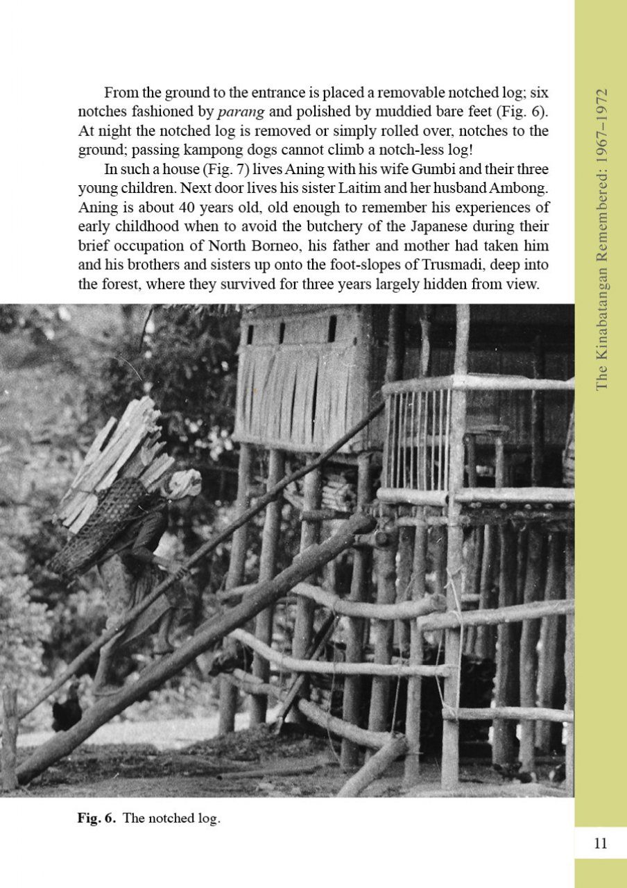
United States
£ GBP
This is the story of the Sungai Kinabatangan, a river in Sabah, Malaysia, and its people, as it was precisely 50 years ago. It follows the great river as it meanders its way across central Sabah, from its source in misty montane forests, through vast tracts of rainforests to its immense estuary of mangrove swamps fronting the Sulu Sea. Between source and mouth it is a river of marked contrasts: of crystal-clear headwaters flowing over boulder-strewn beds; of fast-flowing upper reaches, subject to rapid fluctuations of level, and of a broad floodplain periodically inundated by angry swirling waters.
Fewer than 25,000 people lived in the area at that time and they looked to the river and its tributaries for their means of communication – there were no roads. With few exceptions their kampongs, of frail bamboo houses, were situated on the river banks. These self-sufficient communities obtained the essentials of life, food and shelter from the surrounding forests and the river itself, by hunting, collecting, fishing and tending their crops of rice and tapioca.
Fully illustrated with photographs, all taken at the time and written as surveys of the river catchment proceeded, The Kinabatangan Remembered rekindles memories of times past. With road networks now widely established, how many of us can remember how alive and vital this great river was to the heart of Sabah?
1. Introduction
2. Source: Trusmadi
3. Headwaters: The Labau Valley
4. Preparation For The Kinabatangan Survey
5. Upper Reaches: The Labau Valley, Beyond The Gorge
6. Upper Reaches: Pinangah Valley
7. Upper Reaches: Tongod Valley
8. Upper Reaches: Karamuak Valley
9. Upper Reaches: Kuamut Valley
0. Middle Reaches: From Kuamut To Pintasan
11. Floodplain: From Pintasan To Lamag
12. Floodplain: From Lamag To Batu Puteh
13. Floodplain And Swamps: From Batu Puteh To Sukau
14. Lower Floodplain: From Sukau To Abai
15. Estuary: From Abai To Mumiang
16. Coast
17. Unlocked Secrets