United States
£ GBP
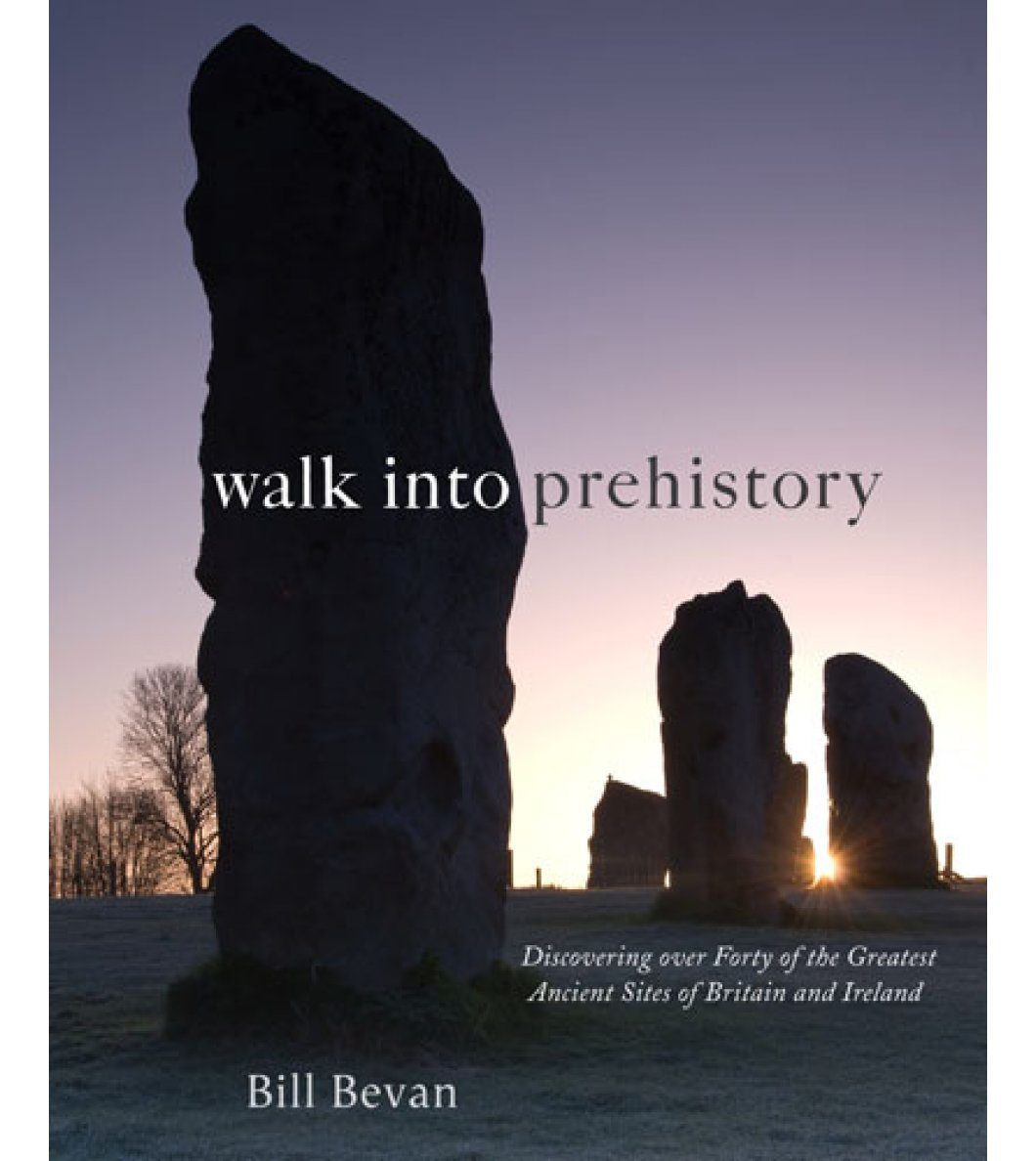
A unique illustrated guidebook to walking 40 of Britain and Ireland's most important and impressive prehistoric monuments.
Ranging from stone circles and henges to hillforts and burial chambers, Bill Bevan describes how these monuments were deliberately built and located to be seen and approached from certain directions. Processional routes led to ceremonies at stone circles, henges and tombs. Hillforts were built and designed to look imposing from specific directions to deter potential attackers. There are even ancient long-distance paths like the Ridgeway which are accessible today.
The walks lead you back in time from the modern landscape to reconstruct in the mind's eye what the prehistoric landscape would have looked like. The history and significance of each monument is discussed and generously illustrated with new colour photographs. For each walk there is a specially commisioned colour map and directions and there are also grid references, OS map recommendations and difficulty gradings, with family friendly walks highlighted.
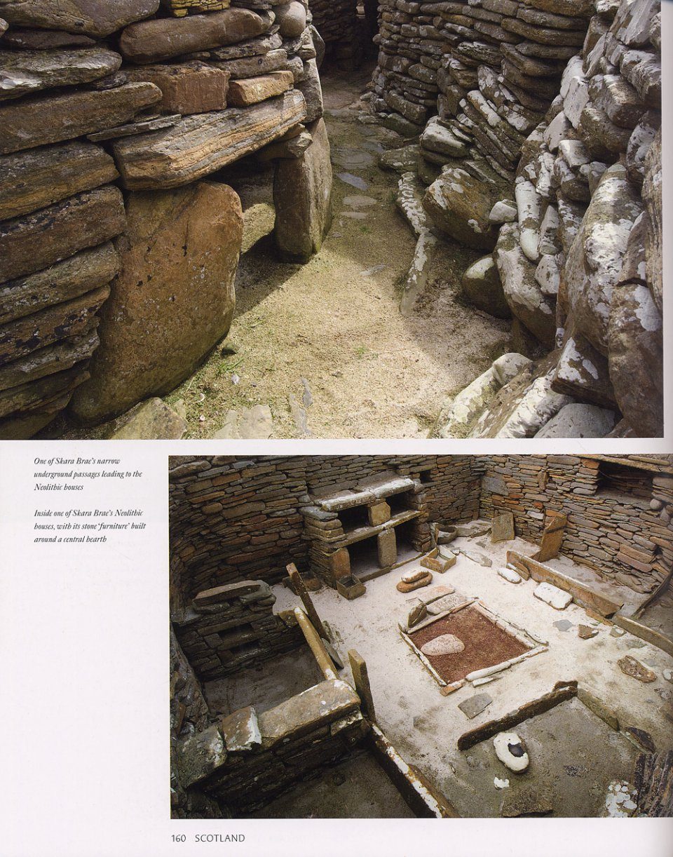
From Stonehenge to Skara Brae, from the imposing hillfort at Tre'r Ceiri to the Newgrange tomb illuminated by the widwinter sunrise, this book helps you to follow in the footsteps of the people who created Britain's extraordinary ancient heritage.
IRELAND
Uragh
Beaghmore Stone Circle Newgrange
Hill of Tara
Navan Fort
Carrowkeel
Poulnabrone
SCOTLAND
Balnuaran of Clava
Callanish
Dun Carloway
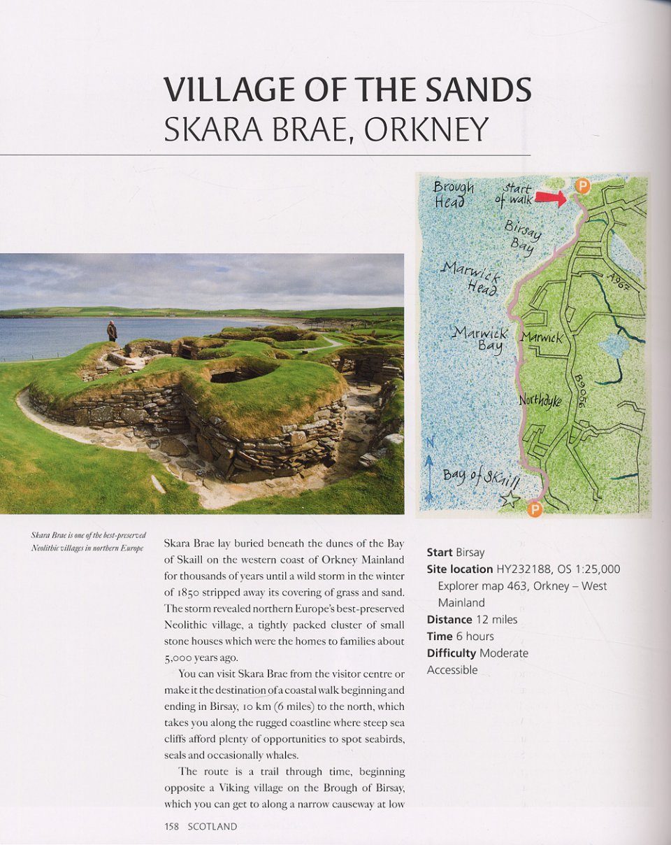
Skara Brae
Ring of Brodgar
Stones of Stenness
Maes Howe
Watch Stone
Broch of Gurness
Kilmartin
Loanhead of Daviot
Glenelg brochs
Camster Grey Cairns and Hill O'Many Staines
NORTHERN ENGLAND
Castlerigg
Mayburgh
King Arthur's Round Table
Yeavering
Mam Tor
Arbor Low
SOUTHERN ENGLAND
Ridgeway
Avebury
Stonehenge
Maiden Castle
Dartmoor
Chysauster
British Camp
WALES
Bryn Cader Faner
Tre'r Ceiri hillfort
Foel Drygarn hillfort
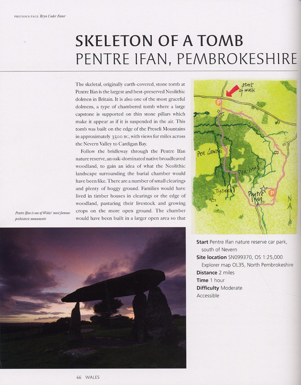
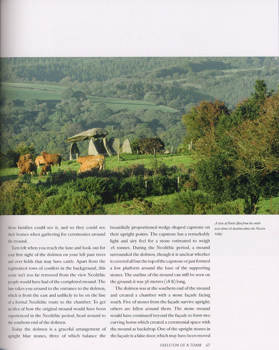
Pentre Ifan
Bryn Celli Ddu burial chamber