To see accurate pricing, please choose your delivery country.
 
 
United States
£ GBP
All Shops

British Wildlife

8 issues per year 84 pages per issue Subscription only

British Wildlife is the leading natural history magazine in the UK, providing essential reading for both enthusiast and professional naturalists and wildlife conservationists. Published eight times a year, British Wildlife bridges the gap between popular writing and scientific literature through a combination of long-form articles, regular columns and reports, book reviews and letters.

Subscriptions from £33 per year

Conservation Land Management

4 issues per year 44 pages per issue Subscription only

Conservation Land Management (CLM) is a quarterly magazine that is widely regarded as essential reading for all who are involved in land management for nature conservation, across the British Isles. CLM includes long-form articles, events listings, publication reviews, new product information and updates, reports of conferences and letters.

Subscriptions from £26 per year
Academic & Professional Books  Reference  Data Analysis & Modelling  Cartography, Remote Sensing, Image Analysis & GIS

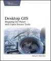
Desktop GIS Mapping the Planet with Open Source Tools

Handbook / Manual Out of Print
By: Gary E Sherman
368 pages
Desktop GIS
Click to have a closer look
  • Desktop GIS ISBN: 9781934356067 Paperback Oct 2008 Out of Print #178452
About this book Biography Related titles

About this book

Desktop GIS explores the world of Open Source GIS software and provides a guide to navigate the many options available. Discover what kind of GIS user you are and lay the foundation to evaluate the options and decide what software is best for you. "Desktop GIS" examines the challenges associated with assembling and using an OSGIS toolkit. You'll find strategies for choosing a platform, selecting the right tools, integration, managing change, and getting support. The survey of OSGIS desktop applications provides you with a quick introduction to the many packages available.

You'll see examples of both GUI (Graphical User Interface) and command line interfaces to give you a feel for what is available. This book will give you an understanding of the Open Source GIS landscape, along with a detailed look at the major desktop applications, including GRASS, Quantum GIS, uDig, spatial databases, GMT, and other command line tools. Finally, this book exposes you to scripting in the OSGIS world, using Python, shell, and other languages to visualize, digitize, and analyze your data.

Customer Reviews

Biography

Coming from a natural sciences background, Gary Sherman has been torturing computers and programming languages for years. Gary has been using and customizing Geographic Information Systems for well over 16 years. In 2002 he founded the Quantum GIS project, an Open Source desktop GIS application for viewing and editing data. Gary lives and works in Alaska and commutes virutally around the world via the Internet.
Handbook / Manual Out of Print
By: Gary E Sherman
368 pages
Current promotions
New and Forthcoming BooksNHBS Moth TrapBritish Wildlife MagazineBuyers Guides