To see accurate pricing, please choose your delivery country.
 
 
United States
£ GBP
All Shops

British Wildlife

8 issues per year 84 pages per issue Subscription only

British Wildlife is the leading natural history magazine in the UK, providing essential reading for both enthusiast and professional naturalists and wildlife conservationists. Published eight times a year, British Wildlife bridges the gap between popular writing and scientific literature through a combination of long-form articles, regular columns and reports, book reviews and letters.

Subscriptions from £33 per year

Conservation Land Management

4 issues per year 44 pages per issue Subscription only

Conservation Land Management (CLM) is a quarterly magazine that is widely regarded as essential reading for all who are involved in land management for nature conservation, across the British Isles. CLM includes long-form articles, events listings, publication reviews, new product information and updates, reports of conferences and letters.

Subscriptions from £26 per year
Academic & Professional Books  Reference  Data Analysis & Modelling  Cartography, Remote Sensing, Image Analysis & GIS

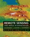
Remote Sensing and Image Interpretation

Textbook Out of Print
By: Thomas M Lillesand(Author), Ralph W Kiefer(Author), JW Chipman(Author)
756 pages, 25 colour plates, b/w photos, illustrations, maps, tables
Remote Sensing and Image Interpretation
Click to have a closer look
  • Remote Sensing and Image Interpretation ISBN: 9780470052457 Edition: 6 Hardback Aug 2008 Out of Print #175679
About this book Contents Related titles Recommended titles

About this book

Remote sensing is the science and art of obtaining information about an object, area, or phenomenon through the analysis of data acquired by a device that is not in contact with the object, area, or phenomenon under investigation. Providing an exciting introduction to the field, Remote Sensing and Image Interpretation covers the science of remote sensing from physical basis to sensors and applications. The new Sixth Edition not only offers the latest information, but also has been revised to make the material more accessible.

Contents

1. Concepts and Foundations of Remote Sensing
2. Elements of Photographic Systems
3. Basic Principles of Photogrammetry
4. Introduction to Visual Image Interpretation
5. Multispectral, Thermal and Hyperspectral Sensing
6. Earth Resource Satellites Operating in the Opticak Spectrum
7. Digital Image Interpretation and Analysis
8. Microwave and Lidar Sensing

Appendix A Radiometric Concepts, Terminology and Units
Appendix B Remote Sensing Data and Information Resources
Appendix C Sample Coordinate Transformation and Resampling Procedures
Appendix D Radar Signal Concepts, Terminology and Units

Customer Reviews

Textbook Out of Print
By: Thomas M Lillesand(Author), Ralph W Kiefer(Author), JW Chipman(Author)
756 pages, 25 colour plates, b/w photos, illustrations, maps, tables
Current promotions
New and Forthcoming BooksNHBS Moth TrapBritish Wildlife MagazineBuyers Guides