Um genaue Preise zu sehen, wählen Sie bitte Ihr Lieferland.
 
 
United States
£ GBP
Alle Kategorien

British Wildlife

8 issues per year 84 Seiten per Ausgabe Nur im Abonnement erhältlich

British Wildlife is the leading natural history magazine in the UK, providing essential reading for both enthusiast and professional naturalists and wildlife conservationists. Published eight times a year, British Wildlife bridges the gap between popular writing and scientific literature through a combination of long-form articles, regular columns and reports, book reviews and letters.

Abonnement ab £33 im Jahr

Conservation Land Management

4 Auflagen im Jahr 44 Seiten Nur im Abonnement erhältlich

Conservation Land Management (CLM) ist ein Mitgliedermagazin und erscheint viermal im Jahr. Das Magazin gilt allgemein als unverzichtbare Lektüre für alle Personen, die sich aktiv für das Landmanagement in Großbritannien einsetzen. CLM enthält Artikel in Langform, Veranstaltungslisten, Buchempfehlungen, neue Produktinformationen und Berichte über Konferenzen und Vorträge.

Subscriptions from £26 per year
Akademische und professionelle Bücher  Natural History  Outdoor Pursuits

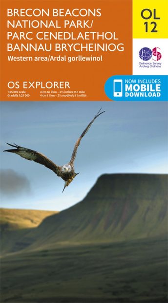
OS Explorer Map OL12: Brecon Beacons National Park (Western Area) / Parc Cenedlaethol Bannau Brycheiniog (Ardal Gorllewinol)

By: Ordnance Survey (OS)(Author)
colour map, scale 1:25 000
Manufacturer: Ordnance Survey
OS Explorer Map OL12: Brecon Beacons National Park (Western Area) / Parc Cenedlaethol Bannau Brycheiniog (Ardal Gorllewinol)
Click to have a closer look
Select product
  • OS Explorer Map OL12: Brecon Beacons National Park (Western Area) / Parc Cenedlaethol Bannau Brycheiniog (Ardal Gorllewinol) standard Not in stock: Usually dispatched within 1-2 weeks
    £12.99
    #241603
  • OS Explorer Map OL12: Brecon Beacons National Park (Western Area) / Parc Cenedlaethol Bannau Brycheiniog (Ardal Gorllewinol) weatherproof Not in stock: Usually dispatched within 1-2 weeks
    £16.99
    #241604
  • OS Explorer Map OL12: Brecon Beacons National Park (Western Area) / Parc Cenedlaethol Bannau Brycheiniog (Ardal Gorllewinol) standard Out of Print #217607
  • OS Explorer Map OL12: Brecon Beacons National Park (Western Area) / Parc Cenedlaethol Bannau Brycheiniog (Ardal Gorllewinol) weatherproof Out of Print #217606
Selected product: £12.99
About this product Customer reviews Related products
Images Additional images
OS Explorer Map OL12: Brecon Beacons National Park (Western Area) / Parc Cenedlaethol Bannau Brycheiniog (Ardal Gorllewinol)OS Explorer Map OL12: Brecon Beacons National Park (Western Area) / Parc Cenedlaethol Bannau Brycheiniog (Ardal Gorllewinol)OS Explorer Map OL12: Brecon Beacons National Park (Western Area) / Parc Cenedlaethol Bannau Brycheiniog (Ardal Gorllewinol)OS Explorer Map OL12: Brecon Beacons National Park (Western Area) / Parc Cenedlaethol Bannau Brycheiniog (Ardal Gorllewinol)

About this product

Map sheet number OL12 in the Explorer map series is the ideal map for those seeking outdoor adventure. The landscape of the Brecon Beacons attracts walkers, cyclists and riders to its rolling hills, valleys, caves and waterfalls. Highlights include: The Beacons Reservoir, Brecon, Fan Faw, The Black Mountains, Brecon Canal, Merthyr Tydfil, River Towy, and Trecastle.

With the OS Explorer OL12 map of the Brecon Beacons you’ll have no problem finding every imaginable site of interest, from pubs and houses, to viewpoints and rights of way.

From the russet ridges of the Beacons summits, to the dark and mysterious escarpments of the Black Mountains, if you’re an outdoor enthusiast with a passion for stunning natural environments, we’d highly recommend you spend some time here. Walking and hiking opportunities abound in the Brecon Beacons. Immerse yourself in the otherworldly atmosphere that enshrouds the peaks of the Carmarthen Fans and their lakes.

Or if you prefer to travel by bike, trial the Taff Trail for a speedier way to see as many of the area’s spectacular sites as possible. Trot off on the Three Rivers Ride, if you feel four legs are better than two. And get back to nature at Craig Cerrig-Gleisiaid National Nature Reserve.

See some of the best-preserved limestone pavement at Ogof Ffynnan Ddu, near Pen-y-Cae. Discover Neolithic standing stones, Iron Age hill forts and Roman settlements. And spot natural wonders ranging from populations of migrant birds, to unusual plant life at the Talybont Resevoir. Whether you’re going for a day’s leisurely sightseeing in the spectacular Waterfall Country, or a hard day’s hiking in the Black Mountains, don’t forget to pack your essential plan of the Brecon Beacons.

Customer Reviews

By: Ordnance Survey (OS)(Author)
colour map, scale 1:25 000
Manufacturer: Ordnance Survey
Current promotions
New and Forthcoming BooksNHBS Moth TrapBritish Wildlife MagazineBuyers Guides