To see accurate pricing, please choose your delivery country.
 
 
United States
£ GBP
All Shops

British Wildlife

8 issues per year 84 pages per issue Subscription only

British Wildlife is the leading natural history magazine in the UK, providing essential reading for both enthusiast and professional naturalists and wildlife conservationists. Published eight times a year, British Wildlife bridges the gap between popular writing and scientific literature through a combination of long-form articles, regular columns and reports, book reviews and letters.

Subscriptions from £33 per year

Conservation Land Management

4 issues per year 44 pages per issue Subscription only

Conservation Land Management (CLM) is a quarterly magazine that is widely regarded as essential reading for all who are involved in land management for nature conservation, across the British Isles. CLM includes long-form articles, events listings, publication reviews, new product information and updates, reports of conferences and letters.

Subscriptions from £26 per year
Academic & Professional Books  Reference  Data Analysis & Modelling  Cartography, Remote Sensing, Image Analysis & GIS

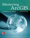
Mastering ArcGIS

Textbook Out of Print
By: Maribeth H Price(Author)
605 pages, colour illustrations
Publisher: McGraw Hill
Mastering ArcGIS
Click to have a closer look
  • Mastering ArcGIS ISBN: 9780078095146 Edition: 7 Spiralbound Feb 2015 Out of Print #235814
About this book Contents Biography Related titles

About this book

Mastering ArcGIS is an introductory GIS text that is designed to offer everything you need to master the basic elements of GIS. The author's step-by-step approach helps students negotiate the challenging tasks involved in learning sophisticated GIS software. An innovative and unique feature of Mastering ArcGIS is its accompanying narrated video clips that show students exactly how to perform chapter tutorials before attempting an exercise on their own.

Contents

INTRODUCTION What is GIS?

Chapter 1: GIS Data
Chapter 2: Managing GIS Data
Chapter 3: Coordinate Systems
Chapter 4: Mapping GIS Data
Chapter 5: Presenting GIS Data
Chapter 6: Attribute Data
Chapter 7: Basic Editing
Chapter 8: Queries
Chapter 9: Spatial Joins
Chapter 10: Map Overlay and Geoprocessing
Chapter 11: Raster Analysis
Chapter 12: Editing and Topology
Chapter 13: Geodatabases
Chapter 14: Metadata Skills

Reference
Glossary
Selected Answers
Index
Conversion Table

Customer Reviews

Biography

Maribeth Price is a professor at the South Dakota School of Mines and Tech.

Textbook Out of Print
By: Maribeth H Price(Author)
605 pages, colour illustrations
Publisher: McGraw Hill
Current promotions
New and Forthcoming BooksNHBS Moth TrapBritish Wildlife MagazineBuyers Guides